Winter really is coming.
Meteorological winter is still 21 days away(!), but a very cold Canadian air mass that is pushing into the upper Midwest today and tonight will bring wintry weather for a day or two before moderating early next week.
Chicagoans: bundle up and prepare for a very cold end to the work week.
A very cold morning
The culprit of the early shot of winter is a robust surface high pressure that originated in northern Alaska and has spun all the way around a stubborn trough centered on the territory of Nunavut (that hasn't seem to want to budge for the past week). The surface high is registering sea level pressures of 1038-1040. As you would expect, it's also associated with some really chilly temperatures, extending up through 850mb:

As the high spins into the upper midwest and sinks southeastward it will moderate slightly, but not before delivering a shot of very cold air on Friday morning:
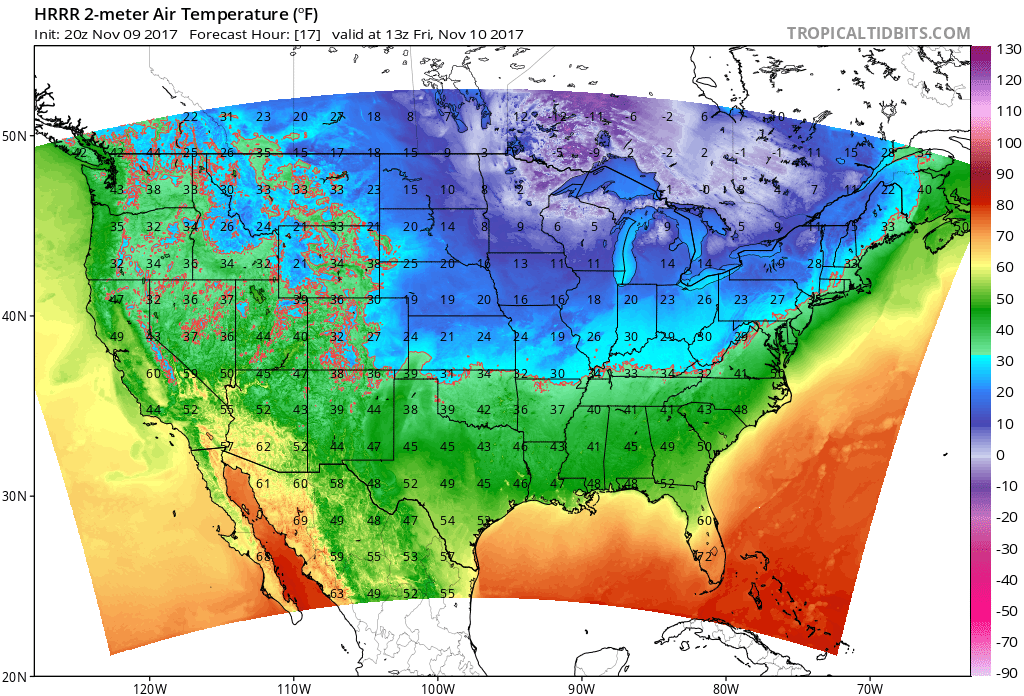
The current hi-res models are forecasting lows in the upper-teens for inland Chicago and lower-teens for the suburbs (low 20s at the lake?) The record low for tomorrow morning in Chicago is 18F, so we will be very very close to that!
Make sure to BUNDLE UP!
**(If we do get a record low tomorrow this will be our first record low of 2017, compared to 12 record highs, fyi)**
Lake effect snow?
Because the very cold air mass will be blowing over a warm Lake Michigan (surface water temperatures are hovering near 50), we will experience our first lake-effect snow of the season! As the high spins eastward, the change in wind direction should push a light to moderate band of snow over the Chicago metro area sometime around mid-day tomorrow (Friday) before pushing off Friday night.
Chilly weekend, moderating next week
Saturday and Sunday will moderate, with temperatures in the low 40s and rain around, but the trough should shift slightly east next week and we may see 50s againon Tuesday and Wednesday! :)