It MAY rain this week. (get it? get it?!)
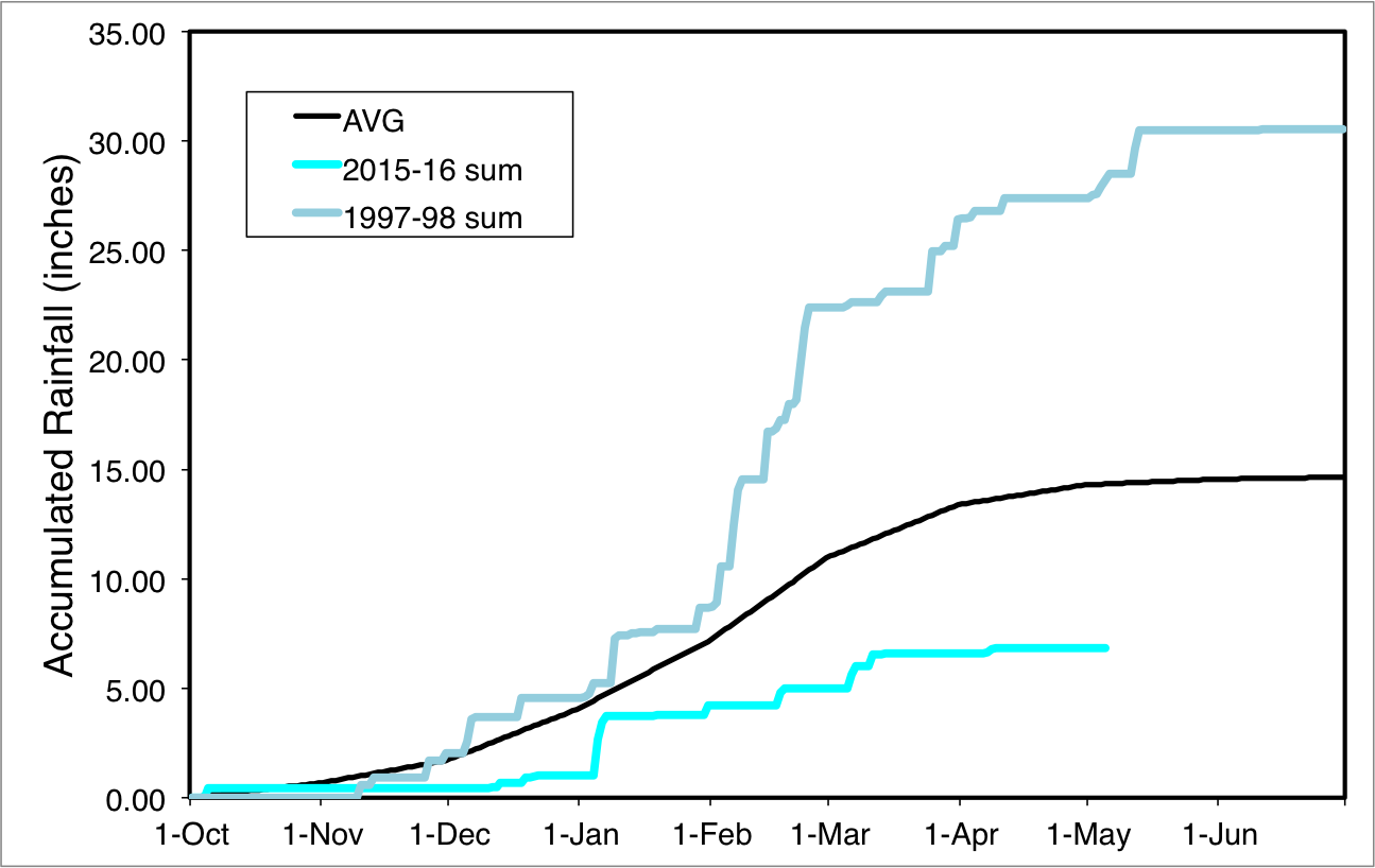
May usually marks the very end of the "rain season" in Los Angeles. As I've said numerous times before this, this year's rain season, despite a historically strong El Nino, was a total dud in LA. (And much of California, actually). Here's the pathetic chart of rainfall through May 5:
Early May T-storms?
That said, things are lining up for at least a shot at some unsettled weather beginning today and running through Saturday. This won't be a "typical" winter-type storm. Yes, it's a cold upper-level Low Pressure dropping down from the north. Howeverm, if it rains, most of the rain will result from convective processes (i.e. the land/ocean is warmer and the atmosphere is colder). Some mechanical lifting may be provided by both orographics and a low-level jet, as well as the presence of relatively higher precipitable water (available moisture) to aid in convection. The presence of convective rain means the chance of thunderstorms will be high.
Here's a look at predicted CAPE (convectively available potential energy) for Friday morning:

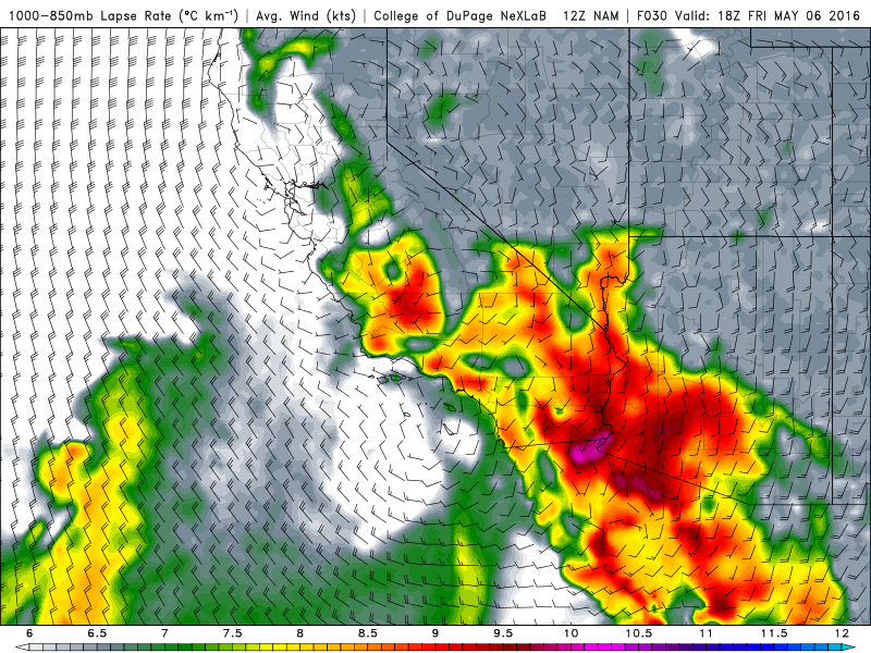
And a look at the "lapse rate" (higher lapse rates = higher chance of convection) for the same time period:
What's the forecast, Mike?
So, if things play out like the models suggest, we could be looking at an approximate 24-hour period of unsettled weather today through Saturday with the best chance of thunderstorms occurring between early Friday morning (before 4am) through Friday evening.
It's difficult to pinpoint HOW MUCH rain will fall, but models suggest anywhere from nothing to an inch may fall (totals will be highly variable under thunderstorm cells):

Stay tuned if or when we get actual thunderstorms!